
Walk a Glen Cove Street by Address
A Glen Cove street search works best as a parcel trail, not as a list of people. The county assessment layer supplies the current situs address and SBL, while the map places that parcel among the addresses around it. The Clerk's land index then supplies the recorded-document trail. A name in an assessment or deed record identifies a stated role at a stated time. It does not by itself establish who is currently at the address.
- Enter the house number, street, town, and ZIP in the Nassau Land Record Viewer, or start with a known Section, Block, and Lot.
- Record the situs, displayed SBL, assessment date, and map context. Keep owner mailing information separate from the property location.
- Open the GIS viewer to orient the parcel on the Glen Cove street and identify nearby parcel boundaries.
- Conform the SBL to the County Clerk format, then search the current land index for deeds and related filings.
- For a past period, use direct and reverse historic indexes, maps, newspapers, and a dated directory entry rather than treating a present parcel result as a historical answer.
That order turns an address into a documented record trail. It also keeps the street directory focused on public parcel evidence rather than unsupported household claims.
Glen Cove Street Directory Starts With a Parcel
The Nassau County Land Record Viewer is the address-first research layer for a Glen Cove street directory. It brings together assessment-roll material, district information, tax maps, property photographs, past taxes, tax rates, exemptions, comparable sales, and a county parcel map. Its results are research clues, subject to the viewer's no-warranty notice. Preserve the displayed date and do not recast an assessment owner as a confirmed occupant.
The official Land Record Viewer search is shown here with its SBL and address entry paths.
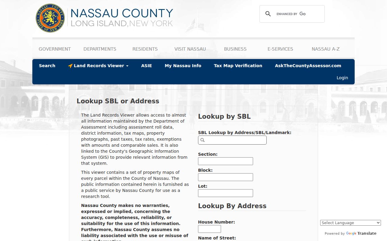
Use the returned parcel as a bridge to the tax map and recorded land documents, while retaining the difference between a property situs and an owner mailing address.
| Land Record Viewer search | Inputs and handling |
|---|---|
| SBL lookup | Section, Block, and Lot, with address, SBL, or landmark lookup. |
| Address lookup | House number, street name, town, ZIP, CAPTCHA, then Search or Clear. |
| Street entry rule | Viewer instructions say to omit directional terms and artery suffixes such as Road, Street, or Avenue in the street field. |
| Account option | The official page says an account can bypass CAPTCHA. |
Note: The viewer and Clerk can use different SBL placeholders, so confirm the Clerk-ready identifier before ordering or citing a land record.
Glen Cove Streets in County GIS
The Nassau County GIS map viewer adds geographic context to an address result. Use it to see parcel placement and available layers, then return to the assessment and Clerk sources for ownership, assessment, and legal-description evidence. The automated review could not read every live GIS widget because the viewer requires a supported browser and JavaScript, so a layer or map display should not be described as proof of a person.
For street normalization, the City Public Works list recognizes Glen Street, School Street, Landing, Shore, Cedar Swamp, Cottage Row, Dosoris, Pearsall, Sea Cliff, and Town Path among its local routes. A modern spelling is useful for the current viewer. Older material may require a second name in the search.
Keep map work and identity work separate. A GIS parcel outline can show which lot sits beside a road or intersects a particular block, but it does not supply a legal description on its own. The county assessment record supplies the parcel fields, and the Clerk's documents establish the recorded land transaction. For a street directory result, retain the map as geographic context and cite the assessment or recorded document for the named role.
This separation is useful along a road with several similar numbers or a curved parcel line. It also prevents a visual boundary from being mistaken for an address record. When a map layer and the assessment view disagree, preserve both retrieval dates and ask the responsible county office which source controls the question at hand.
Glen Cove Street Records by Address
Different address-keyed records answer different questions. The Glen Cove street directory should show the custodian and limitation with each result, particularly where a name might be an owner, applicant, or historical business contact rather than a resident. The following records form the usable local chain.
| Address record | Custodian | Useful return | How to reach it |
|---|---|---|---|
| Assessment and parcel layer | Nassau Department of Assessment | Situs, SBL, tax and assessment context, sales, map and photo | Land Record Viewer and county GIS |
| Recorded land documents | Nassau County Clerk | Deeds, mortgages, assignments, satisfactions, liens, book or page trail | Current index, historic repository, certified-copy request |
| Building and certificate material | Glen Cove Building Department | Permit, inspection, or Certificate of Occupancy chronology | Specific department request or City FOIL |
| Historic address evidence | Glen Cove History Room | Directory, newspaper, census, map, and obituary leads at a date | Library holdings, microfilm, appointment, or online collection where available |
| Street and building context | Library of Congress and local collections | Parcel setting, structures, street alignment, and map-sheet context | Sanborn map sets and History Room materials |
A municipal request should identify the address, SBL where known, date range, and a reasonably specific record description. The city did not publish a general online permit or code-violation index in the reviewed official sources, so a missing web result is not evidence that a record does not exist.
Glen Cove Street Directory Deed Trail
The assessment record points to the formal conveyance trail, but it is not the same record. The Nassau current official land index is the official route for later deeds, mortgages, assignments, satisfactions, liens, and related filings. The Clerk says ownership information is not supplied by telephone or email. An SBL is the fastest in-person route and helps prevent a false match on a similar street name.
The current Nassau land-record index is shown here as the handoff from an assessment search to recorded documents.
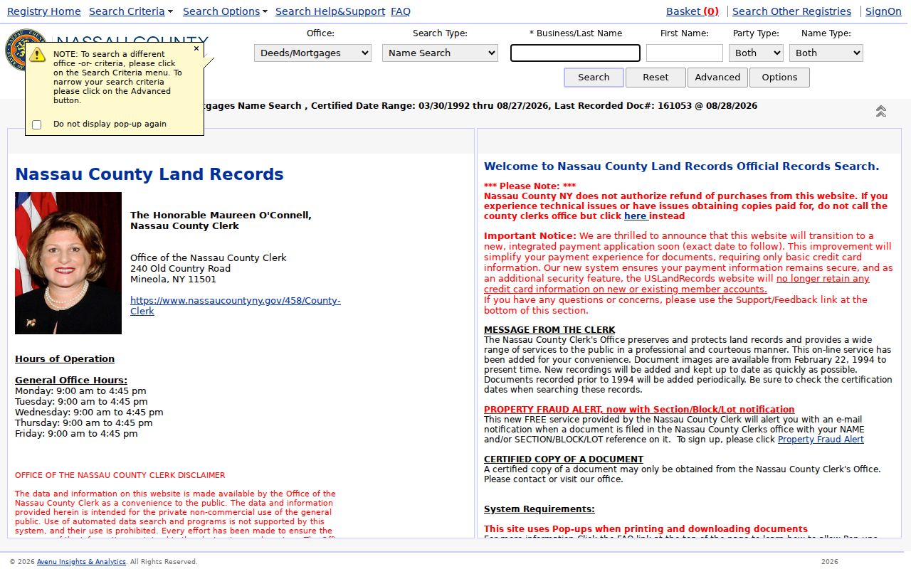
Record the instrument date, grantor and grantee roles, and any book, page, or instrument detail before following the previous conveyance. For material before the electronic database began in July 1992, switch to the historic repository and its direct and reverse indexes.
The Clerk's current procedures provide several access channels when a web result is not enough: e-recording for filings, mail or delivery, a lobby drop box, and in-person service. The general office hours listed in the research are Monday through Friday, 9:00 a.m. to 4:30 p.m., excluding holidays. The older deed packet lists in-person certified copies at five dollars and mail requests with a five-dollar search fee, but those figures should be checked with the Clerk because the packet is older. Credit-card charges also have listed convenience and transaction fees.
Glen Cove Street Directory Municipal Files
Address-based City material can date changes that the deed index cannot. The Glen Cove Building Department handles plans, permits, inspections, and Certificates of Occupancy. The published building application uses property fields for Section, Block, Lot, zoning district, and property address, along with work and certification fields. Those fields make a narrow address request more useful than a broad demand for personal information.
The Glen Cove FOIL form asks for a date, contact information, reasonably specific description, and address or SBL where applicable. It states a five-day acknowledgment, a twenty-business-day response period, a 25-cent per-page fee for pages up to 9 by 14 inches, actual duplication cost for larger material, and a 30-day appeal path. Direct the request to the City Clerk or the department that created the record.
Note: FOIL provides access to existing records; it does not require Glen Cove to create a street-by-street list or disclose exempt private material.
Historic Glen Cove Street Names
Old names can break an otherwise careful address search. The 1867 Bowne directory describes Glen Street as including what became School Street, Main Street as Landing Road, South Street as Glen Cove Avenue, Bay Street in the direction of Garvies Point Road, Front Street in the direction of Shore Road, and Pulaski in connection with the mill dam and Mill Street. Treat each as a source-specific research lead, not a universal conversion rule.
Check a historical name against a contemporary map, deed, Sanborn sheet, or newspaper issue before assigning it to a modern parcel. The 1902 and 1908 Sanborn sheets and the 1923-24 Polk directory are especially useful for dated local context. The story of Maple becoming Stanco and Willow becoming Capobianco preserves local memory, but it still needs map or directory confirmation in an address trail.
Glen Cove Street Directory Older Records
The Nassau historic official records repository is the handoff when a current-index search reaches its time boundary. Its search choices include Document Name or Book Number, Record Type, Search Through Document Text, year from and to, and Enable Page Search. Historic material includes 1840-1934 index books, direct and reverse indexes, official records, deed records, marriage-license material, and plat books.
Search an older street name and the modern form separately when the map evidence supports both. OCR and handwriting can miss a name, so inspect the scanned page and keep its book, page, or image reference. A historic hit explains an address at a particular time; it does not establish a current street household.
Glen Cove Street Directory Terms
Street research is clearer when a few terms stay distinct. The Land Record Viewer and Clerk use related identifiers, but their sources answer different questions.
- Parcel
- A defined piece of real property represented in the assessment and map systems.
- Situs address
- The physical property location, which can differ from an owner's mailing address.
- SBL
- Section, Block, and Lot, the parcel identifier used to connect county systems.
- Plat
- A recorded map or plan that can help show lot layout and subdivision context.
- Criss-cross directory
- A reverse address-oriented directory used as a dated household or business lead, subject to the collection's coverage.
Those distinctions prevent a map point, mailing address, or old listing from being treated as a current address claim.
Glen Cove Street Records Have Limits
Parcel information can show an assessment owner or recorded grantee, while a directory or newspaper can show a past connection at its publication date. Neither produces a verified current household list. The NYS voter lookup is a voter identity and registration check that requires the voter's own identifying inputs; it is not a block roster. Confidential voter registration and the New York Address Confidentiality Program also protect qualifying records.
Lawful personal use. Glen Cove address records are useful for personal research, family history, property questions, and civic transparency. Do not use them to stalk, harass, intimidate, or expose a protected person.
For a named historical entry, consult the Glen Cove city directory collections for the dated source rather than extending one current parcel result backward without evidence.