
Glen Cove Neighbors Through Block Records
Use sources by what they actually establish about a block. The assessment viewer and GIS map provide parcel context. The Clerk's records establish a recorded-document relationship. A historical directory or newspaper can show an old local connection at its date. The records do not combine into a verified, current list of Glen Cove neighbors, and the distinction becomes more important with each parcel added to the search.
| Block source | What it shows about a block | Access |
|---|---|---|
| Nassau Land Record Viewer | Parcel situs, SBL, assessment context, owner mailing field, sales, and map or photo leads | Official county research portal |
| Nassau GIS map viewer | Parcel placement, surrounding lots, and geographic layers | Official county map viewer; verify underlying records |
| Nassau County Clerk | Recorded deeds, mortgages, liens, and parties to a land filing | Current index, historic repository, or Clerk request |
| Glen Cove City records | Address-specific municipal material such as permit, inspection, or Certificate of Occupancy chronology | Department request or a narrow FOIL request |
| History Room sources | Dated directory, newspaper, map, obituary, census, and manuscript leads | Library holdings, appointment, or specified online collection |
Every result should retain the source date and the stated role. A nearby parcel owner is an adjacent owner of record as of that source date, not a statement of who your Glen Cove neighbors are.
Map Glen Cove Neighbor Parcels
The immediate-block method is deliberate. Start at the one address you can identify, use the official map to see the adjoining parcel outlines, and then repeat the official parcel search for each adjacent SBL. This is safer and more accurate than building a bulk person list from names copied across sources. The GIS viewer is a geography tool, while the assessment and Clerk systems provide the fields that require verification.
- Find the starting address in the Nassau Land Record Viewer and record its situs, SBL, and source date.
- Open the Nassau GIS map viewer to identify the parcels that physically adjoin or face the starting parcel.
- Run each adjacent SBL or address separately through the assessment viewer and preserve the returned role as assessment information.
- Use the Clerk's land index only when a deed or other recorded filing is needed to understand a specific parcel relationship.
- Report the result as an adjacent parcel record with a date, then stop if the research question has been answered.
For the longer chain along a named road, the Glen Cove street directory uses a street-by-street address workflow. The block method stays with the immediate surrounding parcels.
Glen Cove Neighbor Records Show Roles
Assessment rolls can pair a Glen Cove property situs with an owner mailing address in Locust Valley or another ZIP. That is normal mailing information, not proof that the owner lives at the parcel. A deed records a grantor or grantee in a legal conveyance, also not a current-occupancy finding. A map shows geography, and a historical directory shows an association at its issue date. Keep the words owner, mailing recipient, grantee, and historical listing separate.
City records follow the same rule. A permit can identify an owner, design professional, contractor, or other stated role in a municipal file. No general public online Glen Cove permit or code-violation index was located in the reviewed sources. Send the responsible department or City Clerk an address, SBL, date range, and specific record description if a particular municipal document is needed.
Glen Cove Blocks Need Street Names
Street normalization matters before checking nearby parcels or historic sources. The current Public Works street list includes Glen Street, School Street, Landing, Shore, Cedar Swamp, Cottage Row, Dosoris, Pearsall, Sea Cliff, and Town Path. The old name in a directory may not be the label a current map or assessment portal expects.
The 1867 Bowne directory offers source-specific clues: Glen Street included what became School Street, Main Street became Landing Road, South Street became Glen Cove Avenue, Bay Street points toward Garvies Point Road, Front Street toward Shore Road, and Pulaski is connected with Mill Street. Confirm any apparent match with a period map, deed, or newspaper. These are research leads, not a single automatic conversion table.
Postal geography also differs from municipal geography. Glen Cove's standard postal ZIP is 11542, while 11560 and 11545 are nearby postal areas. Use a complete USPS address lookup when the mailing ZIP matters, and retain the situs, municipality, postal city, and owner mailing address as separate fields.
Glen Cove Neighbors: Official Tools Compared
Official parcel tools have clear custodians and defined record types. Commercial neighbor-search services may group names and addresses, but their data origin, update date, role labels, and error controls can be unclear. Treat an unnamed commercial result as an unverified lead, not as a block roster. The official sources below make it easier to state exactly what the record supports.
| Official parcel and record sources | Commercial neighbor-search category |
|---|---|
| Identifies the assessment, map, or recorded-document custodian and source date. | May combine data from different dates and sources without a clear custodial record. |
| Separates parcel situs, owner mailing field, SBL, and document party roles. | May blur owner, mailing contact, past association, and current occupancy. |
| Allows a specific parcel or document to be checked at the source. | Requires independent verification before any use. |
Note: The public record is strongest when it stays attached to the originating office, the address or SBL searched, and the date retrieved.
For a recorded transfer, verify the instrument in the Nassau County Clerk's current land index or historic repository. For assessment context, return to the Land Record Viewer. This two-source check is especially useful when an owner mailing field is outside Glen Cove or when a name appears in a historical source. The extra step may narrow a record, but it does not turn it into evidence of current occupancy.
Glen Cove Community Resources, Not Rosters
Community sources can help explain a place, research local history, or find a public program. They should not be mined for current household membership. The research found no official Glen Cove neighborhood-association roster, and a library-hosted local issue treats Shore Road Neighbors as an informal civic lead rather than a list to copy. These publicly identified resources are useful starting points for place-based research.
Glen Cove's forms and permits page is shown here because it routes address-specific City requests and forms without publishing a general neighborhood roster.
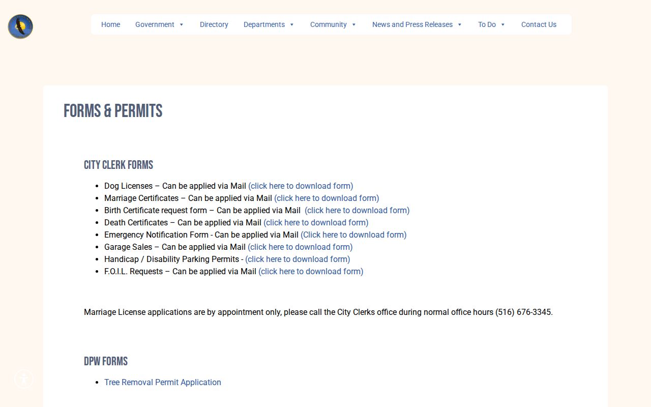
Use the form and City Clerk route for a particular municipal record, not for a demand to create a list of people around an address.
| Public resource | Glen Cove use | Access note |
|---|---|---|
| Robert R. Coles Long Island History Room | Maps, newspapers, directories, manuscripts, photographs, microfilm, and genealogy leads | Monday 2-5, Thursday 9-noon, or appointment; ask staff for the relevant collection |
| North Shore Historical Museum | Local maps, objects, ephemera, and civic-history context in the 1907 Justice Court Building | Hours can differ; call ahead before visiting |
| City Orchard BOA material | Municipal context for the Orchard study area and former Sea Cliff Avenue industrial corridor | Area description, not a person directory |
Orchard History Adds Glen Cove Block Context
The Orchard is a useful example of why block research needs dates. The History Room's Orchard material pairs 1902 and 1908 Sanborn maps with a 1923-24 Polk directory to connect local businesses with First, Cedar Swamp, Grove, and Capobianco. It also reports the historical renaming of Maple for Aniello Stanco and Willow for Luigi Capobianco. That material offers terms to search in historical maps and newspapers without making any claim about a current household.
City Orchard material describes a study area bounded by the southern city border, the Long Island Rail Road to the west and north, and Cedar Swamp Road to the east. Boundaries, industrial history, and changing street labels can all explain why an address appears under more than one local description.
Glen Cove Neighbor Privacy Limits
New York's voter lookup is a voter identity and registration check requiring identifying inputs, not a public block roster. Voter files have an elections-purpose restriction under Election Law section 3-103(5), and qualifying confidential registrations are kept separate under Election Law section 5-508. The New York Address Confidentiality Program also protects qualifying addresses. Do not copy dates of birth, signatures, protected addresses, or other sensitive fields into a neighborhood list.
New York FOIL, Public Officers Law Article 6, permits requests for reasonably described existing records but does not compel an agency to create a people list or release exempt safety and privacy material. A narrow City FOIL request is appropriate for a record type, address, and date range. It is not a route to private contact details.
The City FOIL form asks for a requester name, contact details, a reasonably specific description, and an address or SBL when applicable. It states a five-day acknowledgment, a twenty-business-day response period, and a 30-day appeal path. The form also lists a 25-cent per-page fee for pages no larger than 9 by 14 inches and actual duplication cost for larger material. Those procedures support a focused record request, not a neighborhood dossier.
Lawful personal use. Use public Glen Cove parcel and community records for personal research, civic context, and family history. Do not use them to stalk, harass, intimidate, or expose anyone.